The VT-BAM project

Progress map:
Corrected places that had patches I didn't even know existed (Tambov-Voronezh border, the rest of Odessa's third levels and third levels for a place in southeastern Bavaria)
Division Progress Map.png
 
I've done some work on that old Weimar Republic i nabbed off here a while ago, decided to fix up those outdated borders to a more accurate version i got from an NSDAP reichsgaue map also from this thread.

Very likely that there may be minor inaccuracies here and there, but otherwise it's good.
If you do find inaccuracies or can improve upon this map, feel free to fix it up!

Next up: German Empire.

Edit 1: Fixed small screwup with saar border.
 

Attachments

  • VT-BAM_Weimar_Republic.png
    VT-BAM_Weimar_Republic.png
    56.3 KB · Views: 531
Last edited:
Happy beginning of autumn to everyone. The Russian North Caucasus Federal District is completely done. I also changed the Chechen-Ingush border a bit (according to this), and added reservoirs in northern Dagestan. The total is somewhere just over a thousand rural settlements and urban districts, not counting the Chechnya done before me.
View attachment 853745

Post Scriptum: someone, please make a rework of the Caspian coast already. I used Yandex, and practically everything is different there, especially in Astrakhan region. And Yandex is a Russian company, I think Russians are much better at their own geography than some others.
View attachment 853748
Would it be possible to finish Ukraine too?
 
By the way, I found a map from somewhere containing the rest of Odessa's third levels which for some reason wasn't shown in the latest tile patch, I've put the map below.
1694765046733.png
 
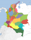
After a few false starts and attempts at learning QGIS, I finally sat down and got all of Colombia's 1st divs done. Still don't quite understand QGIS but hey its done now.
I ran into some complications trying to line up Klime's overlays with modern border changes, eventually I just made my own that matches up pretty close, same dimensions and resolution and whatnot just with the changes.

Colored versions are to help distinguish the funky river exclave-y bits.
 

Attachments

  • States of Colombia Pasted Filled.png
    States of Colombia Pasted Filled.png
    129.8 KB · Views: 317
  • States of Colombia Filled.png
    States of Colombia Filled.png
    50.8 KB · Views: 216
  • States of Colombia Lines.png
    States of Colombia Lines.png
    53 KB · Views: 239
  • States of Colombia Pasted.png
    States of Colombia Pasted.png
    102.7 KB · Views: 393
Last edited:
This is a patch for Hawaiian 3rd levels I made from maps from https://www.discounthawaiicarrental.com/en-us/travel-tips/best-beaches-on-the-big-island/ (this is one of the links) they had maps that had third levels of the Big Island, Oahu, Maui and Kauai. However I couldn't find data about Molokai' island if that has divisions so you're on your own for that.
View attachment 848750
Updated my VT-BAM atlas index thing to include all the non-historical admin div posts since April.

Also I think I found a more up to date version of that map, or a more up to date version of what its citing.
 
After a few false starts and attempts at learning QGIS, I finally sat down and got all of Colombia's 1st divs done. Still don't quite understand QGIS but hey its done now.
I ran into some complications trying to line up Klime's overlays with modern border changes, eventually I just made my own that matches up pretty close, same dimensions and resolution and whatnot just with the changes.

Colored versions are to help distinguish the funky river exclave-y bits.
Amazing work! However I do have to mention that the map you likely used was an old one from before Venezuela was complete, please consider using a more updated map if you're making something like this in the future.
 
Last edited:
Also I know since 2020 the administrative divisions in Ukraine have changed but let's be honest the old ones are way more useful and if they are done I can make the new ones out of them in literally an hour.
There, the administrative-territorial division has not changed at all. Yes, the districts have become much larger, but their boundaries follow the same places where the boundaries of the old districts used to be. And those same old districts have become 'communities'. So, to put it simply, level 2 became level 3, level 3 became level 4, and so on. So there are no problems, you just have to change colours, and new level 2 is even easier to make. Thanks for the maps, though.
 
Ever so slightly late but here we are: The German Empire!
The usual warning of possible minor inaccuracies applies, but this time there's another thing: That eastern border may not be pixel perfect, as i took it from a rather old 1815 map i nabbed off Deviantart
(Or was it that old german empire borders image?)

Either way, here it is.
 

Attachments

  • VT-BAM_German_Empire.png
    VT-BAM_German_Empire.png
    63 KB · Views: 478
There, the administrative-territorial division has not changed at all. Yes, the districts have become much larger, but their boundaries follow the same places where the boundaries of the old districts used to be. And those same old districts have become 'communities'. So, to put it simply, level 2 became level 3, level 3 became level 4, and so on. So there are no problems, you just have to change colours, and new level 2 is even easier to make. Thanks for the maps, though.
Believe me, I have studied the administrative divisons of Ukraine (new and old) a lot, and it's not like that. The districts have become larger by merging, but their borders do not always follow the old ones, there are some districts where a few settlements changed hands or dsitricts that were split in half. Then the old districts didn't always become communities, although sometimes. The old communities were merged together into new bigger ones, but they almost never follow the boundaries of the old districts. And with this there is also no 4th level, there is still 3 just like there were, but all except the 1st with different borders. Now like I said this was all done on the basis of merging and amalgamating the communities, there was no border "redrawing" in the strict sense, so if we have the old divisions down to the communities the new ones can be easily done. I have in fact already done the new divisions for the oblasts that we have finished already.
 
Last edited:
Believe me, I have studied the administrative divisons of Ukraine (new and old) a lot, and it's not like that. The districts have become larger by merging, but their borders do not always follow the old ones, there are some districts where a few settlements changed hands or dsitricts that were split in half. Then the old districts didn't always become communities, although sometimes. The old communities were merged together into new bigger ones, but they almost never follow the boundaries of the old districts. And with this there is also no 4th level, there is still 3 just like there were, but all except the 1st with different borders. Now like I said this was all done on the basis of merging and amalgamating the communities, there was no border "redrawing" in the strict sense, so if we have the old divisions down to the communities the new ones can be easily done. I have in fact already done the new divisions for the oblasts that we have finished already.
Oh, okay. I won't contrast your long study with my quick glance. Especially since I noticed the points you described above after the post.
 
Top